Mega-moisture packed storm set to soak Colorado with heavy rain and deep mountain snow
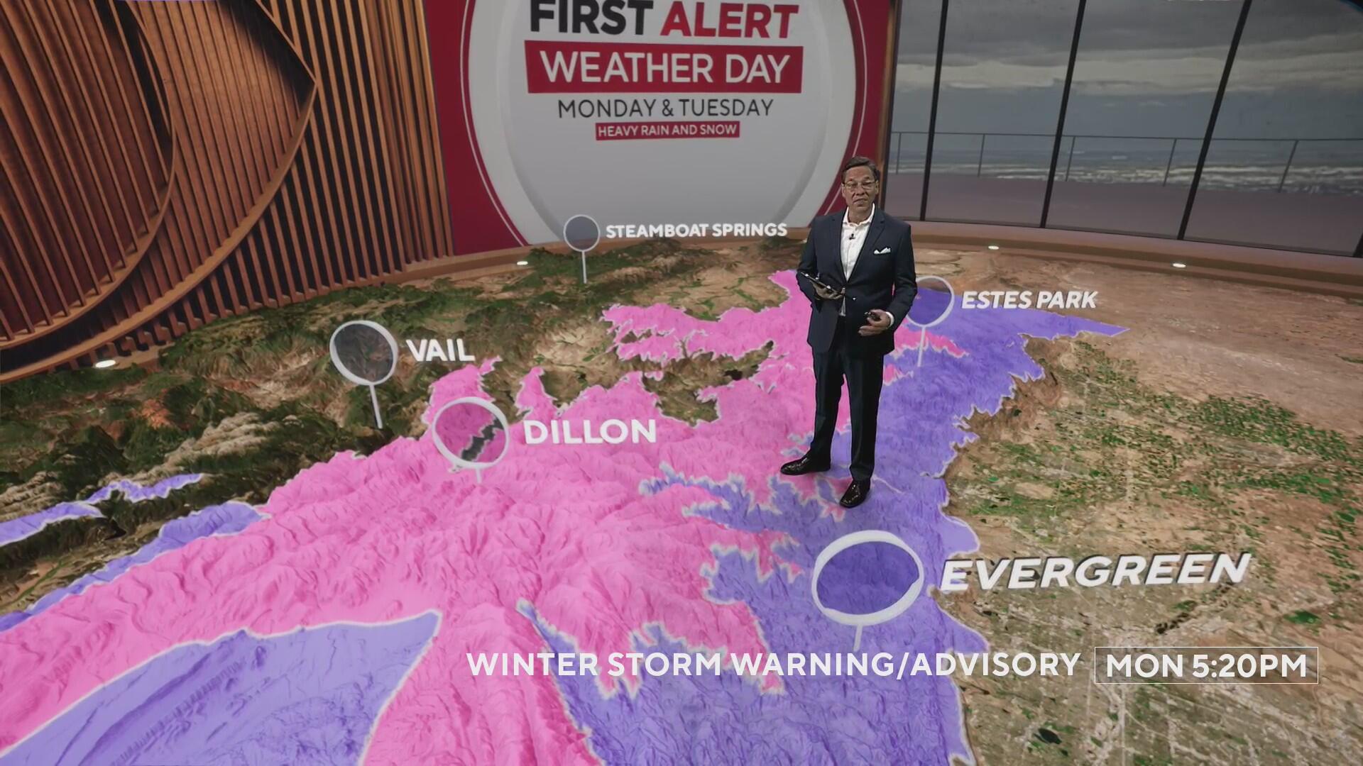
Moisture rich storm systems set to soak Colorado's Front Range and eastern plains with heavy rain and heavy mountain snow! We have launched a First Alert Weather Day for Tuesday for the big weather change.

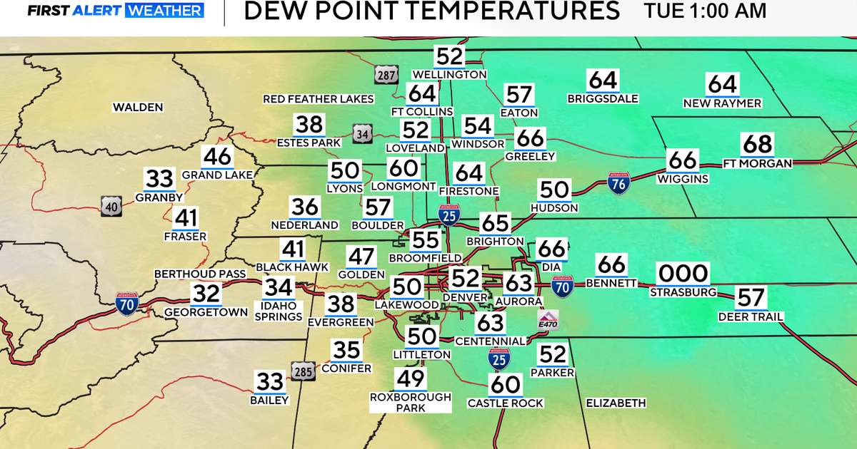
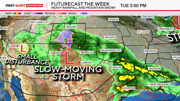
The storm system is a slow moving Arizona low that will move across northern New Mexico on Tuesday bringing in a strong upslope and mixing in a strong pipeline of gulf moisture from Texas as it lumbers across the central Rockies.
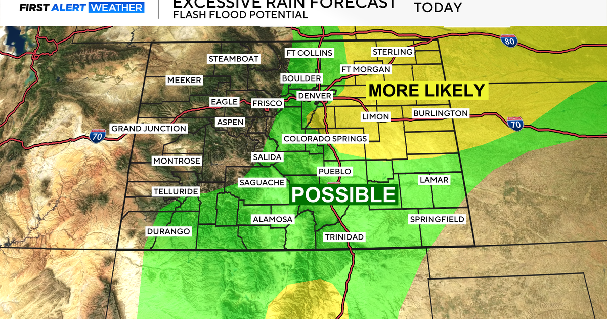
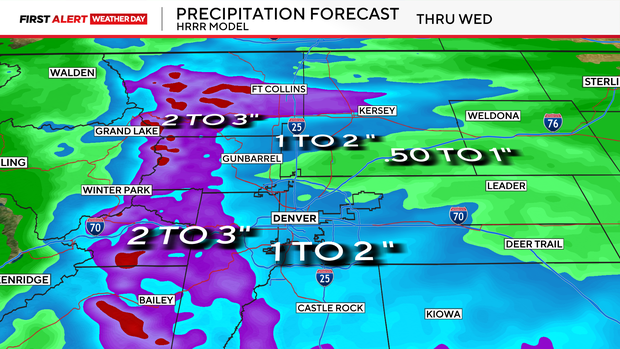
Denver and the eastern plains will see heavy rain showers develop Tuesday morning into Tuesday afternoon. Some areas may see 1 to 2 inches of rainfall by Wednesday with a little more on Thursday. This may cause a few areas of ponding water and minor flooding in prone areas.
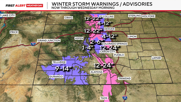
For the Front Range Mountains and Foothills snow level may drop as low as 7,500 feet! There are Winter Storm Warnings and advisories in place for those spots. Some areas may see 1 to 2 feet of snow.
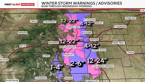
There is the chance for some of the higher areas of Pikes Peak seeing 2 to 4 feet of snow by Wednesday night! Southern Colorado mountains will see more than a foot of snow as well this week.